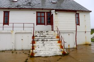
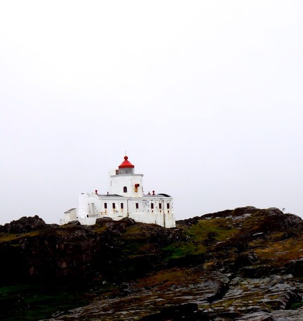
![]() Makkaur fyrstasjon ligger helt ytterst i Båtsfjorden. Fyrbygningen er en betongbygning med hvelvet tak og tårn på taket. Anlegget har klare likhetstrekk med betongbebyggelsen på Geitungen fyrstasjon i Rogaland, og Sletringen fyrstasjon i Sør-Trøndelag. Et 3. ordens lynblinkapparat, maskinhall med trykktanker til diafon tåkeanlegg og aggregater er intakt. Fyrbygningen og fyrvokterboligen er bevart fra før krigen. En tørrmurt vei går mellom fyrbygningen og den øvrige bebyggelsen. Denne omfatter bolig
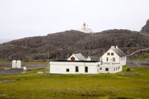
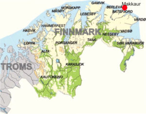
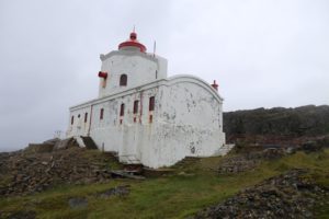
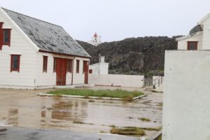
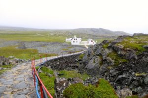
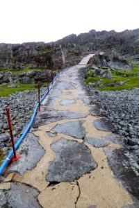
Makkaur fyrstasjon ligger helt ytterst i Båtsfjorden. Fyrbygningen er en betongbygning med hvelvet tak og tårn på taket. Anlegget har klare likhetstrekk med betongbebyggelsen på Geitungen fyrstasjon i Rogaland, og Sletringen fyrstasjon i Sør-Trøndelag. Et 3. ordens lynblinkapparat, maskinhall med trykktanker til diafon tåkeanlegg og aggregater er intakt. Fyrbygningen og fyrvokterboligen er bevart fra før krigen. En tørrmurt vei går mellom fyrbygningen og den øvrige bebyggelsen. Denne omfatter bolig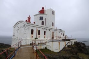 er, uthus og tufter etter bolig og uthus. Bygningene ble revet så sent som på 1980-tallet og en dårlig tilpasset bygning som i dag brukes til bolig og maskinhus, ble satt opp utenfor tunet. En støpt vei fører ned til naust og landing. Fyrbygningen har en dominerende plassering på toppen av en knaus i et opprevet fjellandskap, og fyrbygningen er en av landets mest særpregede.
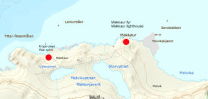
Fyrbygningen har høy arkitektonisk verdi som eksempel på betongbyggeri med sterke trekk fra industriarkitektur. Fyrstasjonen har miljøbetydning sett i sammenheng med det nedlagte fiskeværet Gamle Makkaur, og rester etter et tysk kystfort 1 km unna.
Kilde: Norsk Fyrhistorisk forening
Fyret ble bygget i 1928, Tårnet er 13, 5 meter. Lyshøyden er 39 meter. Vinkelen på lyset er 17,6 grader. Fyret ble automatisert i 2005.
![]() Makkaur’s fortress is located at the far end of the Båtsfjord. The building is a concrete building with vaulted ceiling and tower on the roof. The plant has clear resemblance to the concrete structure of the Geitungen Foundation in Rogaland, and the Sletringen Foundation in Sør-Trøndelag. A 3rd-order flashblower, machine tank with pressure tanks for diafon fog systems and aggregates is intact. The lighthouse building and the four-lighthouse dwelling are preserved before the war. A dry-walled road runs between the four-story building and the rest of the building. This includes housing, outbuildings and tufts for residential and outbuildings. The buildings were demolished as late as the 1980s, and a poorly adapted building, currently used for housing and machine houses, was set up outside the yard. A cast road leads down to the boathouse and landing. The lighthouse building has a dominant position on top of a crush in a rugged mountain landscape, and the quay building is one of the country’s most
Makkaur’s fortress is located at the far end of the Båtsfjord. The building is a concrete building with vaulted ceiling and tower on the roof. The plant has clear resemblance to the concrete structure of the Geitungen Foundation in Rogaland, and the Sletringen Foundation in Sør-Trøndelag. A 3rd-order flashblower, machine tank with pressure tanks for diafon fog systems and aggregates is intact. The lighthouse building and the four-lighthouse dwelling are preserved before the war. A dry-walled road runs between the four-story building and the rest of the building. This includes housing, outbuildings and tufts for residential and outbuildings. The buildings were demolished as late as the 1980s, and a poorly adapted building, currently used for housing and machine houses, was set up outside the yard. A cast road leads down to the boathouse and landing. The lighthouse building has a dominant position on top of a crush in a rugged mountain landscape, and the quay building is one of the country’s most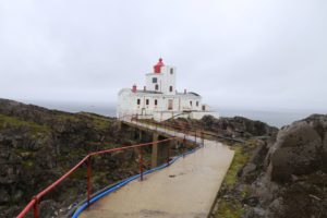 distinctive.
The building has a high architectural value as an example of concrete construction with strong features from industrial architecture. The lighthouse has environmental significance in connection with the closed fishing village Old Makkaur
and remains after a German coastal fort 1 km away.
Source: Norsk Fyrhistorisk Forening
The lighthouse was built in 1928, the tower is 13, 5 meters. Light height is 39 meters. The angle of the light is 17.6 degrees. The lighthouse was automated in 2005.
Source: Wikipedia
/esh

